
Walk a Brambleton Street by Address
For Brambleton street directory research, treat each address as a separate record match. Brambleton is a Census-Designated Place in Loudoun County, not an incorporated city, and its common postal line is Ashburn, Virginia 20148. County systems therefore supply the useful address records. An assessment result can identify an owner or taxpayer, a GIS result can identify the parcel, and a deed can identify recorded parties. None alone establishes who is presently at the address. Capture the date of each result so later checks can compare like with like.
Start broad enough to find the road, then confirm the precise parcel before joining records. The sequence below keeps map geography, assessment data, historical instruments, and regulated voter information in their proper lanes.
- Search the number and street in the Loudoun assessment database. Save the property address, PIN or tax-map reference, subdivision or legal description, and the result date.
- Open the same address in WebLogis. Select the autocomplete suggestion, rather than pressing Enter, then inspect the parcel boundary, address point, road centerline, ZIP, CDP, and subdivision layers.
- Use the parcel or legal description to locate the latest recorded instrument in the Clerk's TrakRecord/PAX index. Compare the parcel details before connecting a named party to the address.
- For construction timing, compare the PIN or street address against the residential permit layer and issued permit reports. A permit dates work on a structure, not a move-in.
- Use voter information only through the lawful Virginia channels. A protected residence can be substituted or withheld, and a precinct list is not an unrestricted street roster.
Note: A Brambleton street result is strongest when its parcel, legal description, and record date agree across the county systems.
Use Brambleton Street Directory Fields
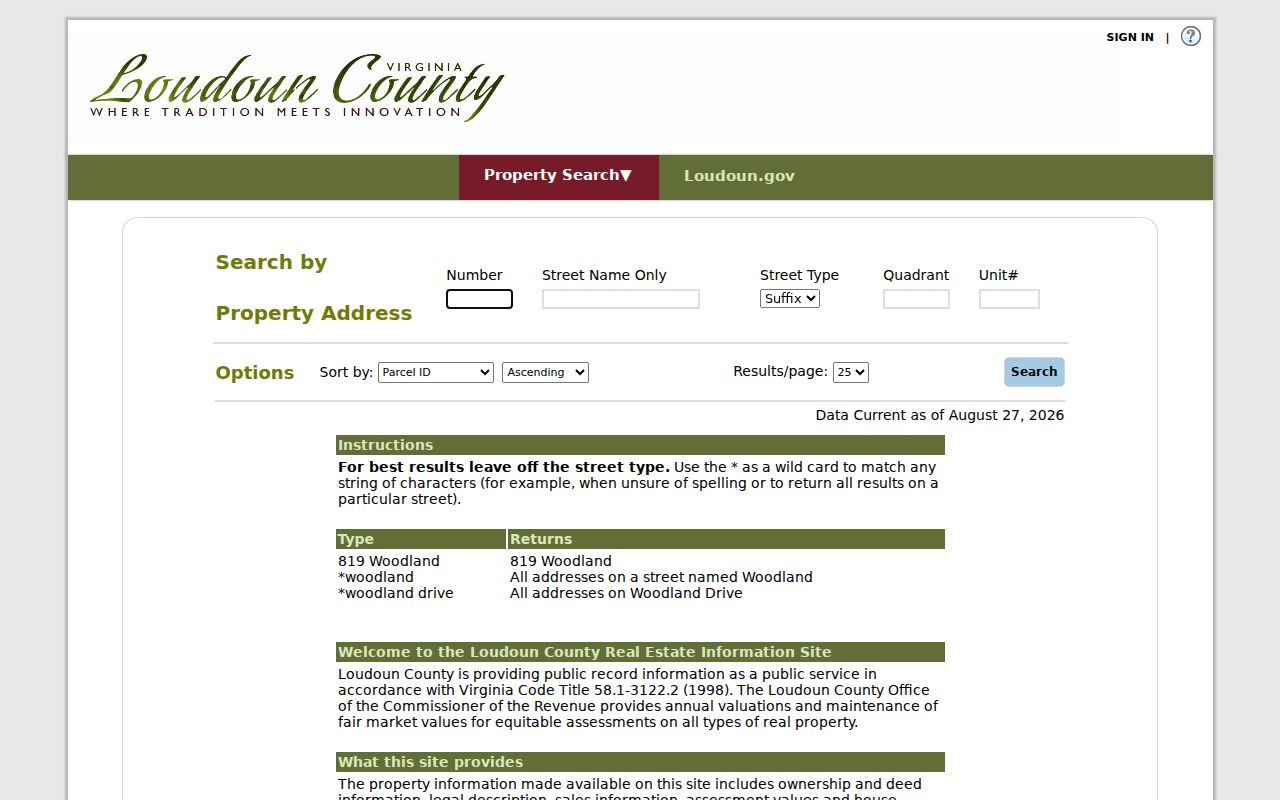
The Loudoun Real Property Assessment Database is the starting point for a Brambleton street directory query. It is updated weekly and offers Property Address, Parcel ID Number, Tax Map Number, Advanced Searches, and Combined Search modes. The inspected address form makes broad road review practical. A query for *woodland returns matching street addresses, while *woodland drive narrows the result by street type. Then use a number and unit to identify the exact parcel. The county reported a maintenance notice during inspection, so live options can change.
Its address form exposes the following fields. The blank fields are useful when a full street inventory, rather than one house number, is needed.
| Assessment field | Input | How it helps by street |
|---|---|---|
| Number | Optional text | Limits a result to one street number. |
| Street Name | Optional text with wildcard | *woodland is broad; add a street type to narrow. |
| Only Street Type | Optional dropdown | Restricts results to the selected road type. |
| Quadrant and Unit# | Optional text | Separates directional addresses and unit-level results. |
| Sort and Results/page | Dropdown controls | Sets result order and page size for review. |
Assessment fields include owner or taxpayer, mailing and property addresses, legal description, sales and assessment data, building facts, and parcel or tax data. The property, or situs, address names the parcel. A mailing address directs tax correspondence. They can match, but they answer different questions. Condominiums also require care because a garage or assigned space can have a separate PIN.
A screenshot of the Brambleton property address search shows the street-level fields used for this first pass.
Use the result list to select candidates, then verify the exact parcel in GIS before relying on a name or mailing field.
Map Brambleton Streets in WebLogis
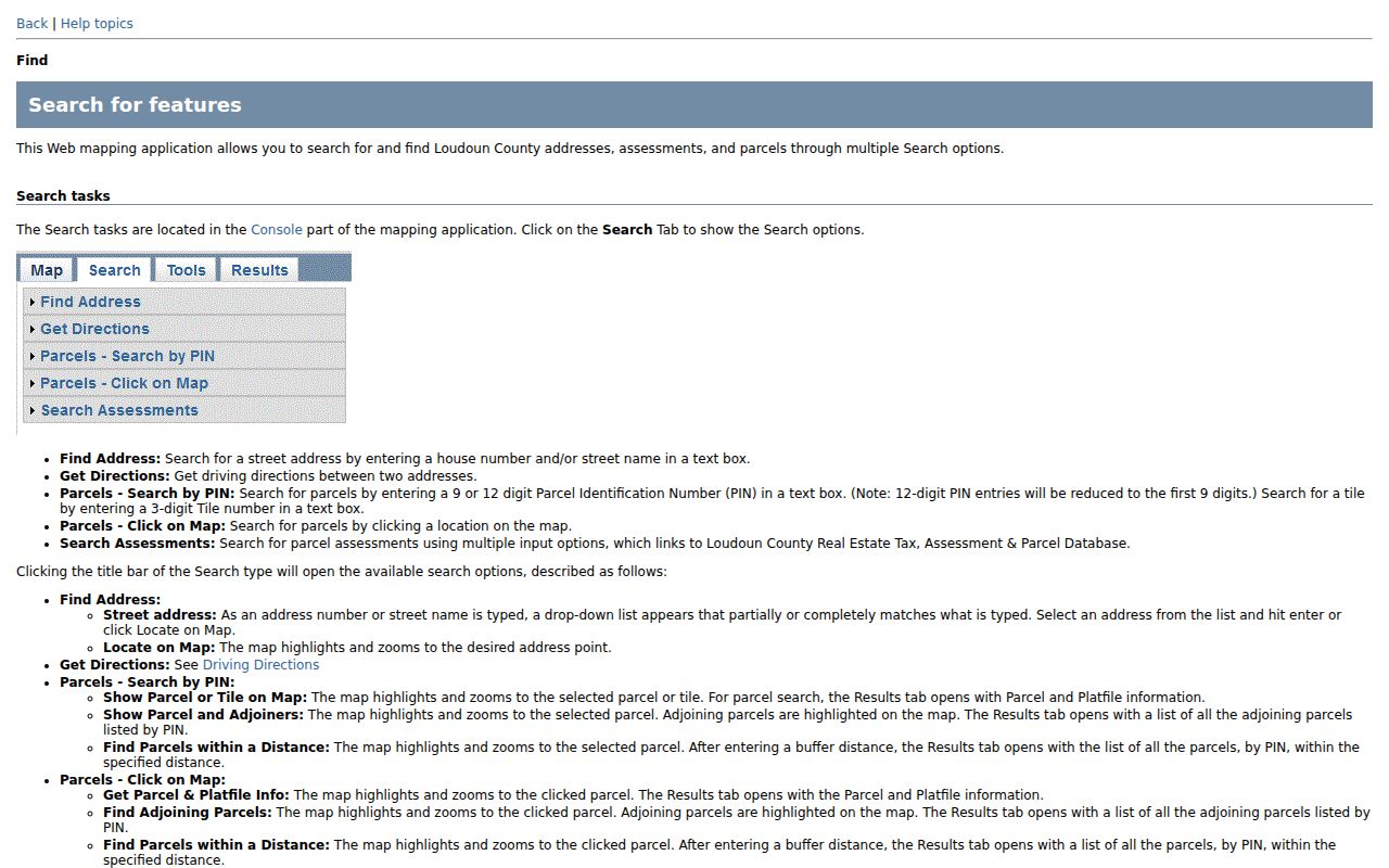
Loudoun WebLogis turns an address into parcel geography. Its public search is by address, PIN, tax map, or map click, not a public owner-name search. Choose the address autocomplete result and use Locate on Map. The parcel panel and map can then be read with address points, road centerlines, parcel boundaries, subdivision labels, ZIP Codes, election districts, planning layers, and CDP layers. That context matters because a road can cross more than one ZIP, district, or mapped area.
For a full Brambleton street directory review, use Show Parcel and Adjoiners to view the selected parcel beside its adjoining parcels. Get Parcel & Platfile Info and Find Adjoining Parcels are additional map tools. WebLogis also supports distance queries, map printing, layer downloads, aerial imagery, and measurement. These are geographic tools. They explain where a parcel lies and how it relates to another parcel, not who is currently there.
The WebLogis search help illustrates the address, PIN, and tax-map route used to center a street query.
After a map result appears, compare its PIN and subdivision label to the assessment result before opening deed or permit records.
Brambleton Street Records by Address
Several Loudoun sources can be keyed to a Brambleton address, but they disclose different kinds of information. The assessment roll is an administrative snapshot. WebLogis is the map and parcel-context layer. The Clerk's land records are the recorded-instrument layer. Permit data documents work and dates, while voter material is governed by its own access rules. The table distinguishes those sources so a street directory does not turn a partial result into a household claim.
| Address record | Where to search | What it can show | Access route |
|---|---|---|---|
| Assessment record | Commissioner of the Revenue database | Owner or taxpayer, mailing and situs addresses, legal and assessment fields | Public address, PIN, or tax-map search |
| Parcel map | WebLogis GIS | Boundary, PIN, ZIP, subdivision, road, and adjoining parcels | Public viewer and map tools |
| Land instrument | Clerk TrakRecord/PAX | Recorded parties, instrument, date, reference, and image route | Free index, paid images, kiosk, or mail request |
| Residential permit | County permit service and reports | Permit, PIN, date, project, street, ZIP, and structure fields | Map service; issued reports from 2015 |
| Precinct list | Loudoun Elections | Limited public statutory voter fields | Controlled public inspection under Virginia law |
The chain works through the parcel identifier. Match the assessor PIN, WebLogis parcel, subdivision or landbay, and deed legal description. For an older address trail, use the historical collections described in the Brambleton city directory material rather than assuming a modern road name existed in every period.
Read Brambleton Street Deeds in PAX
The Loudoun County Clerk of Circuit Court keeps land records from 1757 to the present. TrakRecord/PAX is the remote endpoint for a party and instrument search. Begin with the latest recorded owner or grantee and a deed reference from the current parcel record. Search the earlier party and prior book, page, or instrument reference, while comparing the legal description at every link. Deeds, deeds of trust, assignments, satisfactions, judgments, and subdivision plats belong in different categories and should not be treated as interchangeable title evidence.
Remote access changed in September 2025. Occasional users can reach the index without charge and purchase images when needed. The Clerk also offers free public kiosks at 18 East Market Street in Leesburg, a paid annual subscriber route listed at $262, and mail requests to Historic Records, P.O. Box 550, Leesburg, VA 20178. The Clerk's staff can help visitors access records but do not interpret a title chain. This mix of index, image, kiosk, and mail channels is useful when one route is unavailable.
The remote-access terms separate the free index from paid document images. The inspected occasional-user charge was $0.50 per image page plus a $2 or 4% convenience fee, whichever is greater, for each transaction. At the counter or by mail, letter and legal copies are listed at $0.50 per page, 11 by 17 copies at $1 per page, and certification adds $2 per document. Give the Clerk a book and page or document reference whenever possible.
Note: An indexed party or recorded owner is evidence about an instrument, not proof of present residence at a Brambleton address.
Use Brambleton Landbays and Plats
Modern Brambleton streets sit in a planned community whose homes began in 2001. A WebLogis sample records the subdivision as BRAMBLETON LANDBAY 2 and the postal line as Ashburn, VA 20148. A landbay, subdivision, section, lot, PIN, and legal description can bridge a modern street address to development records more reliably than a postal city alone. A subdivision plat can identify how lots and street layout were created from a larger tract.
The public Loudoun LandRecords ArcGIS service lists ZIP Codes, address points, road centerlines, parcel boundaries, subdivisions, master addresses, and parcel coordinates. It offers a technical alternative when the visual map is slow, but the visual WebLogis viewer remains the clearer first stop for a street-by-street search.
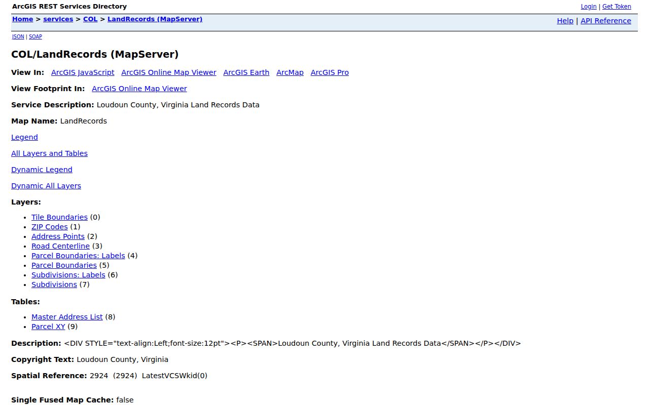
The layer inventory supports a careful comparison of a road, address point, parcel, ZIP, and subdivision without making an identity claim from map data.
- Parcel
- A mapped piece of land tied to a PIN or tax-map reference.
- Situs address
- The address assigned to the physical parcel, distinct from an owner's tax mailing address.
- Plat
- A recorded map that describes lots, boundaries, and subdivision layout.
- Landbay
- A development-area label that can help connect a modern Brambleton lot to related parcel and permit records.
Date Brambleton Street Work With Permits
Loudoun's residential building-permit layer begins in 2010 and runs through the prior year. Its fields include permit number, PIN, issue month and year, street address, unit type, subdivision or project, ZIP, election district, zoning, and related map fields. The county's issued building permit reports provide monthly PDF or Excel reports back to 2015. Use those dates to establish a construction or alteration timeline for a Brambleton street.
For a missing permit detail, the county provides a building and development permit inquiry form. Include the address, PIN, time range, and requested fields. A permit issue, final, or inspection date does not establish who lived at the address. It simply adds dated evidence about the parcel or structure.
Respect Brambleton Street Voter Limits
The Virginia Citizen Portal is for an individual registration-status and polling-place check. Its inputs include name, date of birth, the last four digits of a Social Security number, locality, and an affirmation. It is not a street lookup tool, and a no-match should be taken to the Loudoun Office of Elections, not treated as proof that a person never registered. The local office can answer registration, polling-place, and lawful list-request questions.
Virginia Code §24.2-444 permits public inspection of a precinct list at the registrar's office, subject to protected-address and other statutory exclusions. Qualified voter-list products require the state request form and a permitted requester purpose. Do not copy or aggregate a public precinct list into a Brambleton street directory. Protected voters can use a substitute address, and district boundaries on a map do not reveal voting behavior.
Note: The Elections office controls voter-list access; WebLogis election layers only provide geographic context for an address.
Limits of a Brambleton Street Directory
A Brambleton street directory cannot supply a verified household roster. Assessment data may show an owner or taxpayer and a mailing address. A deed identifies recorded parties. WebLogis maps a parcel. A historical directory or newspaper mention has its own date and context. Those claims can support research when they align, but they remain different claims. Virginia Address Confidentiality Program participants and protected voters may have substitute or withheld residence information.
For a county record not available through the normal portal, make a reasonably specific request under the Virginia Freedom of Information Act. Name the office, record type, time range, address, PIN, or document number, desired format, and whether inspection or copies are wanted. Loudoun must give an initial response within five working days, though exemptions still protect confidential material.
Lawful use. Brambleton address records are for personal, family-history, property-history, and civic research. Never use a record to stalk, harass, intimidate, or harm another person.