
Brambleton Neighbors Source Map
The block around a Brambleton address is best understood through several public sources with different limits. WebLogis maps the surrounding parcels and their geographic context. The assessment record can show public owner or taxpayer fields, the Clerk’s land record index can show recorded parties, and election records have their own statutory access rules. These sources can help explain a block, but none is a complete or current list of the people living there.
| Source | What it shows about a block | Access |
|---|---|---|
| WebLogis | Parcels, PINs, adjoining parcels, addresses, subdivisions, roads, and map overlays. | Public county viewer. |
| Assessment database | Property address, owner or taxpayer, mailing address, legal description, and assessment fields. | Public address, PIN, or tax-map search. |
| Clerk land records | Recorded deed parties, plats, and other property instruments from 1757 forward. | Online index, county kiosk, mail, or counter route. |
| Precinct list | Limited statutory voter fields during public inspection, subject to protected-address rules. | Registrar office under Virginia law. |
| BCA resources | Subassociation names, Town Center, community contacts, and local resource channels. | Public association resources, not a member list. |
Start with the most stable fact, the exact address or parcel. Then note the source date and what it actually establishes. A recorded owner may have a different mailing address, and a parcel boundary does not reveal who presently lives there.
Brambleton Parcel Neighbors Aren't People
A map’s adjoining parcels are geographic neighbors. They are not automatically household neighbors. The Commissioner of the Revenue’s public real-property fields distinguish property or situs address from owner and mailing fields. A deed records parties to an instrument, not a current occupancy statement. The local record system can therefore show a valid property connection while leaving a resident question unanswered.
This distinction also protects against bad matching. One parcel can include more than one unit or a development area, while an attached garage or assigned space can have a separate PIN. A nonlocal mailing address, trust name, or entity name should not be converted into a statement about a Brambleton household. Match the legal description, address, parcel boundary, and record date before using a property record as a context clue.
Map Brambleton Neighbors in WebLogis
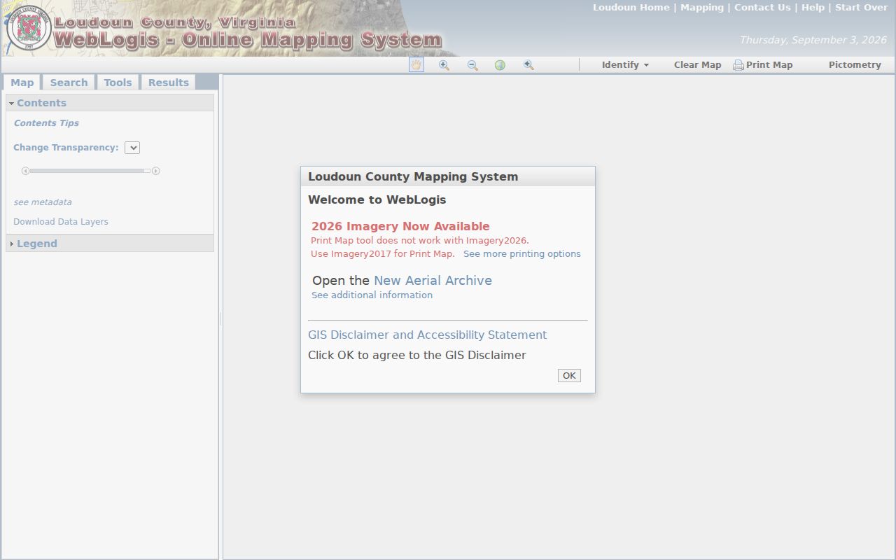
Loudoun WebLogis provides the direct adjacent-parcel method. Enter the street number and street name, choose the autocomplete result, and then locate the address on the map. Selecting the suggested address matters because the county guidance warns that pressing Enter without choosing it can produce an error. From the selected parcel, the viewer can identify the parcel, open land-record information, display the PIN, and show adjoining parcels.
The official WebLogis map illustrates the address, parcel, and adjoining-parcel controls used to define a small block.
Use the result to identify physical neighbors first. Open the linked property record only to review its public fields, and keep a clear distinction between a parcel result and a claim about its occupants.
- Type the address and select the autocomplete result in WebLogis.
- Use Identify, then Land Records and Parcel, to reach the property context and PIN.
- Select Show Parcel and Adjoiners to display the surrounding parcels.
- Compare PINs, legal descriptions, and parcel boundaries before using the Clerk index for a recorded-document question.
Brambleton Neighbors Need Map Layers
WebLogis can put a narrow parcel question in context without turning the map into a person search. Its available layers include ZIP Codes, address points, road centerlines, parcel boundaries and labels, subdivisions, election districts, planning layers, CDPs, schools, utilities, zoning, imagery, and public-safety information. The county ArcGIS LandRecords service also inventories ZIP, address point, road centerline, parcel, subdivision, master-address, and parcel-coordinate layers.
For Brambleton, the CDP, subdivision, and postal overlays are especially useful because the customary postal line is Ashburn VA 20148. A parcel result may show the subdivision BRAMBLETON LANDBAY 2. That development term can provide a better local bridge than an overly broad ZIP result. Election and planning lines explain government geography, but they do not show a person’s registration or voting choice.
Note: A distance tool can display parcels near a selected location, but a radius describes map proximity and should not be used to infer a social or household relationship.
Official Brambleton Neighbor Workflow
The Loudoun Sheriff GeoHub resource documents the official map sequence from an address to a parcel identifier. It uses a sample county address, but the same autocomplete, Identify, Land Records, and Parcel route applies when locating a Brambleton parcel. The underlined PIN opens the property search in a separate tab, giving the map result a direct path to the county assessment record.
The workflow is useful because it connects a map location to a property identifier without guessing at an owner name. If the record needed is a deed or plat, take the PIN, legal description, and subdivision information to the Loudoun TrakRecord/PAX index or use the Clerk’s free public kiosks at 18 East Market Street in Leesburg.
Brambleton Neighbors Community Contacts
The community layer is a contact route, not a public household roster. The Brambleton Community Association provides public resources for subassociations, Town Center, community contacts, schools, places of worship, and local groups. Its public site also links to a Resident Portal and association documents. The reviewed sources did not locate a public member directory, so association membership should not be reconstructed from parcel records or social material.
Brambleton Community Association
42000 Ryan Road, Brambleton, VA. Main phone: 703-542-6263. After-hours: 888-980-8958.
Public resource route
BCA Resources lists public subassociation, Town Center, and community-contact categories.
Local program context
Friends of Brambleton Library publishes meeting and contact information, not a resident roster.
Association pages can help confirm the public name of a neighborhood or the proper contact channel. They cannot validate a household, disclose portal information, or replace county parcel records.
Brambleton Neighbors and Precinct Records
Virginia’s Citizen Portal is for a specific status and polling-place check. It requests name, date of birth, the last four digits of a Social Security number, locality, and an affirmation. It is not a block-search tool, and a no-match does not establish that someone has never registered. For local help, the Loudoun Office of Elections serves registration and list-request questions at 750 Miller Drive SE, Suite 150, Leesburg.
Va. Code §24.2-444 allows public precinct-list inspection at the registrar’s office. Permitted fields can include name, residence address unless protected, year of birth, gender, and election districts. Social Security numbers, driver-license numbers, day and month of birth, protected or substitute addresses, and other protected registration details are excluded. Requests for voter-list products carry qualification, certification, and permitted-use controls.
Brambleton Neighbor Source Comparison
Official and commercial lookup categories answer different questions and deserve different confidence levels. An official record identifies its custodian, field type, and access rule. A commercial tool may combine material from changing sources, but it does not replace a county parcel map, a Clerk instrument, or the registrar’s statutory process. Verify any useful lead with the relevant custodian before relying on it.
| Category | Best use | Important limit |
|---|---|---|
| Official county and state sources | Parcel geography, recorded instruments, assessment fields, and regulated election access. | Each source has a specific scope and can exclude protected information. |
| Commercial lookup category | A starting lead that requires independent checking. | May combine stale or mismatched information and does not prove current residency. |
| Community contacts | Finding an official association or program channel. | Not a substitute for a public member list or a property record. |
County or state domains remain the safest starting point for a record question. A request to unlock a record outside the known public channel is a warning sign, especially when the Clerk and county already publish the proper access route.
Brambleton Neighbor Parcels Have History
Modern Brambleton parcels sit over a much longer Loudoun County record history. The community began receiving homes in 2001, while the county's surviving land and court records reach back to 1757. That difference is useful when a map shows a recent subdivision beside an older parent-tract reference. A landbay, plat, PIN, and legal description can connect a present parcel to the recorded documents that created its lots, but the chain describes land history rather than a list of people who lived on the block.
Permit layers add another date marker. Loudoun's historical residential permit layer begins in 2010, and issued-building-permit reports go back to 2015. An issue or final date can place construction or alteration on a timeline. It cannot show a move-in date, identify a household, or prove a social relationship between adjoining parcels. Keep the map, permit, deed, and occupant questions in their separate record channels.
Brambleton Neighbors Privacy Limits
Virginia access rules are source specific. The Virginia Address Confidentiality Program provides substitute-address protection for eligible participants, and protected voters can appear with a PO box or substitute address. Do not attempt to reverse a substitute address or combine partial results to reconstruct protected information. Sealed court files, juvenile matters, vital records, tax returns, and personal DMV information have separate limits as well.
Virginia FOIA permits reasonably specific requests for public records, but it does not require a public body to create a dossier or defeat a statutory exemption. The county may provide records, cite a lawful withholding, state that no records exist, or explain that more time is needed. Ask for a record type, timeframe, address or PIN, and preferred format rather than requesting all information about a person.